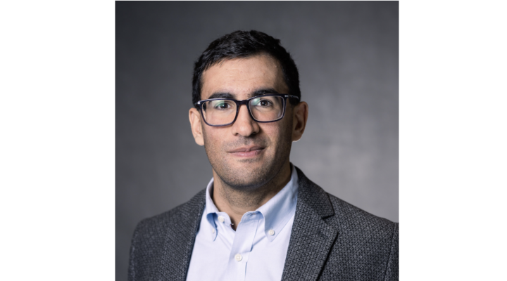
Most of us don’t think about what’s going on below our feet, much less several miles below. Geoffrey Abers is different. The Earth and Atmospheric Sciences professor devotes his research to the movements and behaviors of Earth’s deep interior, and to inform our general understanding about events such as volcano eruptions and earthquakes. “The main theme of my work is to probe these inaccessible parts of the Earth,” says Abers, “to see where fluids are migrating and where magmas are forming--and get good, quantitative images of the physical environment there.”
He first became interested in this field as an undergraduate at Brown University, where he recognized the benefits of a career in earth sciences and geology. “I realized I could take rigorous quantitative skills that I got in physics, and then apply them to interesting problems.” He also liked the fact that the field allowed for students to get out into the field and do hands-on research fairly early-on.
Abers has been continued that hands-on work ever since. As a graduate student at MIT, he traveled to Papua New Guinea to study a particularly active geologic zone where “the Pacific plate and Australian plate are bouncing off of each other and making all these new mountains and ocean basins.” Abers wrote his thesis on how this system actively builds mountains, and continues to study the active rifting zone in this region today.
From there, Abers has traveled to Central America, Alaska, the Pacific Northwest, and, most recently, to the infamous Mount St. Helens to study plate tectonics and to do imaging of the subsurface plumbing beneath this volcano.
Today, earth scientists still rely mostly on rocks and lava chemistry to infer what’s going on beneath the Earth’s surface. Seismometers are helpful as well, but have only just begun reveal the type of information Abers is after. To get the kind of (literally) deep information he’s looking for, Abers sets up broad arrays of seismometers in and around geologically active zones. “For the last 25 years, I’ve been taking increasingly large, dense arrays of seismometers in places where tectonic plates come together, and using the rich complexity of the data they produce to understand the earth’s structure.”
These seismometers measure “precisely record everything that the ground does.” If two seismometers are placed at a distance from each other, their two recordings can reveal a great deal about the earth’s crust in between them. “There’s some similarity to a CAT scan or MRI,” says Abers. “Signals bounce off of things, and give you an image of what’s going on below.” Using these tools, Abers has been able to look at plates a hundred miles deep, and can study what exactly the crust below is made of
Aber’s ongoing field work at Mount St. Helens involves these seismometer arrays, both around the summit, and farther around the mountain, that are able to get images as far as 100 km down into the mantle, in order to better understand how and if magma builds at that depth. “This will help us create more complete models for what happens when these things do erupt,” says Abers.
In addition to this project, Abers is also investigating the use of underwater seismometers off the coast of Washington that can record geologic activity offshore--a new application of the traditional seismometer technology. Abers plans to integrate the data from both offshore and land-bound instruments to get an even better understanding of the behavior of major fault zones.
“My general focus at Cornell is going to be looking at the deep plumbing of volcanic systems, and looking at big active fault systems, “ says Abers, “and taking advantage of the exciting new technologies that can better help us understand these systems.”